InfraWatch
InfraWatch is a national infrastructure intelligence and monitoring platform — a defense-grade command center for the physical assets a country runs on.
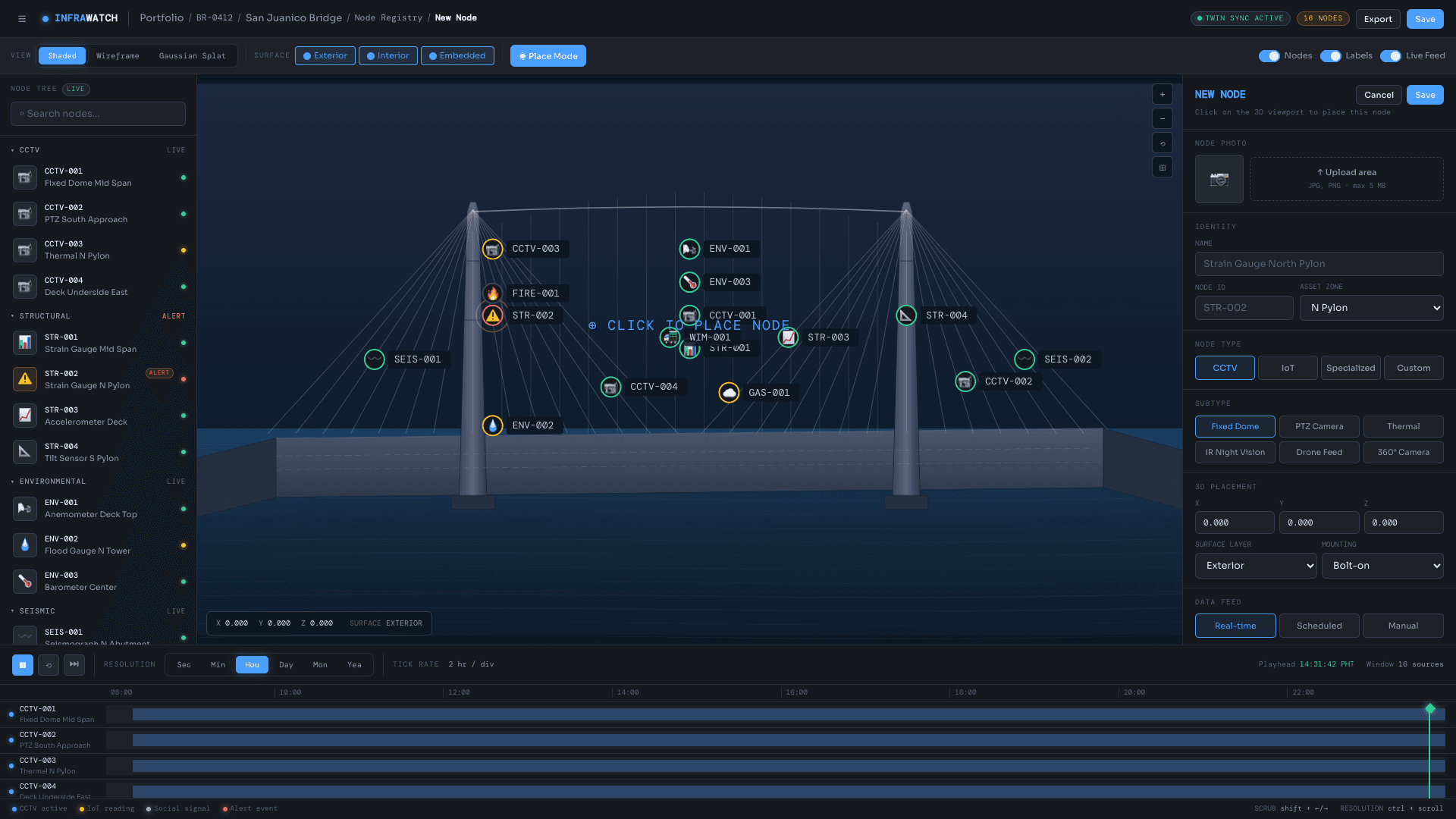
InfraWatch is a national infrastructure intelligence and monitoring platform that unifies the entire lifecycle of a physical asset — from construction, through decades of operation, to eventual decommissioning — in a single system. It serves two markets on one codebase: government agencies managing public infrastructure (transport, public works, disaster response, ports, aviation), and commercial entities managing built property portfolios (developers, REITs, facility operators).
At its core, every asset is represented as a continuously updated digital twin. Twins are generated three ways: from BIM/IFC design files for new construction, from LiDAR point clouds for surveyed structures, and — most distinctively — auto-generated as photorealistic Gaussian Splats from ordinary phone and drone photos, requiring no survey rig or design documentation. Each twin renders in three modes (wireframe, shaded, and photorealistic splat) and serves as the spatial anchor for every sensor registered to the asset, including sensors mounted inside the structure or cast into the concrete itself.
InfraWatch's strongest differentiator is its use of Sentinel-1 satellite radar (InSAR). Because the satellite has imaged the region since 2014, every asset registered in the platform receives up to ten years of retroactive, millimeter-scale ground-deformation history immediately, with no hardware to install — something no hardware-first monitoring vendor can match. Live monitoring is then layered on through vendor-agnostic IoT ingestion: any sensor, from a low-cost GNSS unit to a multi-million-peso robotic total station, connects without lock-in.
The intelligence layer computes several AI-driven scores per asset: a Structural Integrity Score, a Criticality Index derived from a graph model of how assets depend on one another, and a Drift Velocity Score that weights the acceleration of structural movement more heavily than its absolute magnitude. A graph database traverses dependency chains — bridge to highway to hospital to evacuation capacity — to simulate cascade failures across the network rather than treating each asset in isolation.
InfraWatch also extends upstream into the construction phase. By ingesting schedules and records from project management tools (Primavera P6, MS Project, Procore, Aconex, and others) through a single normalized pipeline, it tracks schedule and cost performance, defect density, and contractor reliability — so an asset enters operational monitoring with an accurate structural baseline rather than a blank slate.
The system is built as a polyglot microservices stack and supports fully on-premises deployment to meet government data-sovereignty requirements. It integrates with GeoWatch for real-time hazard feeds (typhoon tracks, seismic shake maps, flood polygons), and during a disaster operates as a multi-agency command center — auto-surfacing the assets, cameras, and sensors closest to a developing threat and corroborating signals across independent sources for audit-grade incident records. In both capability and aesthetic, InfraWatch occupies the same tier as Palantir AIP and Esri ArcGIS Pro, purpose-built for national infrastructure resilience.